When and Where?
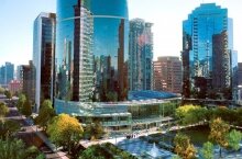
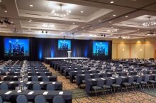
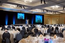
Located in the centre of dynamic Vancouver, British Columbia, Canada, the Sheraton Vancouver Wall Centre is the ideal backdrop for productive meetings. The convention hotel offers spectacular architecture, premier conference facilities, superlative service, and a prime location in the heart of downtown.
June 26-29, 2012 – Vancouver, BC, Canada
Sheraton Vancouver Wall Centre
1088 Burrard Street, Vancouver, BC, Canada V6Z 2R9
How to arrive
Arriving by Bicycle
For more details on cycling routes refer to the cycling maps for Metro Vancouver and for its municipalities, especially TransLink’s and the Cities of Vancouver and, Richmond. These can be accessed from the link – http://www.translink.ca/en/Cycling/Cycling-Routes.aspx. If you prefer to use a planner instead, a cycling trip planer developed by the University of British Columbia can be accessed from the link – . Descriptions of cycling routes will only mention significant roads and paths. Minor and connecting streets will not be identified.
From the Airport – YVR
The route from the airport to the conference venue is primarily along streets with cycling facilities or traffic calmed. A 110 metre high hill needs to be crossed. The trip is approximately 20 kilometres from the airport terminal, McConachie Way, Miller Rd, Sea Island Way, No. 3rd, and River Rd lead to the bike deck on the Canada Line Bridge. On the North Side, Cambie St with its bike lanes is the easiest climb over the hill on the south side of Vancouver. 29th Ave, Midlothian, Ontario, 1st Ave, Quebec St, and the bike path on the shoulder of Union St will lead to the Dunsmuir Viaduct. After a sharp right turn, the separated bike lanes of Dunsmuir and Hornby pass through downtown to the conference venue.
From the Ferry Docks
Tsawwassen Ferry Docks
Wide shoulders on Highway 17 will lead to the bike shuttle. Then River Rd, No 5 Road, bike lanes on Westminster Highway, bike path on Shell Rd, and River Rd on the north side will bring you to the Canada Line Bridge. From there follow the route from the airport.
Alternatively, TransLink’s 640 route bus at the ferry dock will take you through the tunnel to the Steveston bus stop. A short cycle west on Steveston will connect to No 5 Road.
Horseshoe Bay
This route is along bike lanes and local neighbourhood cycling streets. The scenic way to downtown Vancouver is on Marine drive, a narrow, twisty road overlooking English Bay, leading to Lions Gate Bridge. Alternately, the wide cycling designated shoulders of the Upper Cut Highway (Trans Canada Highway #1) and the bike lanes on Capilano Rd lead to the bike path onto the Lions Gate Bridge. On the Vancouver side, Georgia, Gilford, and Comox Streets connect to the conference venue. Both of these streets are local neighbourhood traffic calmed.
From the Train and Bus Station
Terminal St, Quebec, and Main St will lead to the Dunsmuir Viaduct.
From the Borders
Blaine, USA
The simplest route is to cycle north on the King George Boulevard. TransLink’s and the City of Surrey cycling maps will provide alternative routes. Options include using the Queensborough, the Alex Fraser or the Pattulo Bridges. The BC parkway cycling route winds its way into Vancouver
From the Valley
From Port Moody, the Barnet Highway with its designated bike lanes and the Union / Adanac Bike Route is a scenic cycle. Alternately, the paths on the dykes in Pitt Meadows and Port Coquitlam and the Central Valley Greenway provides a more rail-trail experience into Downtown Vancouver..
Getting through George Massey Tunnel
Cycling through the tunnel is not allowed. The tunnel can be traversed either by using the bike shuttle or with TransLink buses. Bike shuttle information and schedule is available at http://www.th.gov.bc.ca/popular-topics/driver_info/route-info/massey/massey.htm. For schedule of the busses, visit the TransLink trip planner – http://tripplanning.translink.ca/.
Combined Mobility
Getting to the conference site by combining cycling and transit
The cycle is getting too much. In Metro Vancouver it is easy to bail out. Just cycle to the next bus stop or to a Canada Line or SkyTrain station and continue the trip on transit. Nothing like a trip combining cycling and transit. All transit buses have bike racks capacity for two bicycles, including the community busses. Restrictions on bicycles on the SkyTrain and Canada Line systems are detailed at http://www.translink.ca/en/Cycling/Bikes-on-Transit/Bikes-on-SkyTrain.aspx.
Remember the transit system fares are zone based. Sometimes the cycle across a bridge reduces the fare. http://www.translink.ca/en/Fares-and-Passes/Fare-Zone-Map.aspx.
General Driving Directions
From East
- From TransCanada Highway 1, take the Hastings Westbound Exit into downtown
- Turn left onto Burrard Street, proceed 6 blocks, and turn left into the hotel.
- From TransCanada Highway 1, take the Hastings Westbound Exit into downtown
- Turn left onto Burrard Street, proceed 6 blocks, and turn left into the hotel.
From Vancouver International Airport
- Follow the signs to Vancouver, over the Arthur Laing Bridge
- Take the Granville Street exit off the Arthur Laing Bridge and follow Granville Street for approximately 10 miles
- Cross the Granville Street Bridge into the downtown core and take the Seymour Street exit. Seymour is a one way street heading north.
- Follow Seymour Street to Helmcken
- Turn left on Helmcken and continue to the end of the street (three blocks). The Wall Centre complex comprises of two tall blue glass buildings located on the right hand corner of Helmcken and Burrard, directly across the street from St. Paul’s Hospital.
From North
- From Highway 99, take the Taylor Way Exit (number 99A)
- Proceed across Lions Gate Bridge, through Stanley Park, onto Georgia Street
- Turn right onto Burrard Street
- Turn left into the hotel
From South
- From Highway 99, continue straight onto Oak Street
- Turn left onto 49th Avenue
- Turn right onto Granville into downtown
- Turn left onto Helmcken Street
- Continue for 2 blocks to the hotel, and turn right into the autocourt
Valet and self-parking available


.jpg)